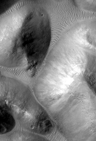

A review of existing images of Mars reveals a diverse landscape. In some instances, such as around volcanoes and in valleys, a casual glance suggests the features are much like those here on Earth. Closer inspection, however, often confirms differences in scale and or subtle characteristics relative to their more familiar terrestrial counterparts.
These same images also reveal a Mars that is often very different form the Earth. Some locations are marked by huge jumbles of blocks forming chaotic terrain (Fig. 1), whereas others are buried beneath blankets of dust. Bizarre “Thumbprint”, “Swiss cheese”, and other surface textures also occur.
Current limits on the resolution of Mars images often preclude distinguishing the of processes responsible for shaping a landscape. The geomorphic thresholds that influence the efficiency and intensity of surface modification by different processes can often be hard to define. Indeed, different processes can sometimes produce very similar appearing landforms. Detecting the subtle, diagnostic signatures of past water erosion versus wind or other processes often requires the high resolution imagery that will be obtained by HiRISE. It is the analysis of HiRISE images that may provide some of the clues for a better understanding of the evolving Martian landscape.


|
Figure 1. Example of chaotic Martian terrain. |
|
John Grant |