|
|
Interactive Mars Data Maps
Contains links to complete MOC narrow-angle image archive |
|
|
Select a region to zoom into it. |
![]()
Full-Scale Global Data Maps
|
These maps are used in the zoomable and queriable data map applet above. For
the purposes of this archive, the thermal inertia and geology maps have been
composited with grayscale MOLA shaded relief maps to aid in orientation.
|
TES Thermal Inertia
|
(Composited with MOLA data)
|
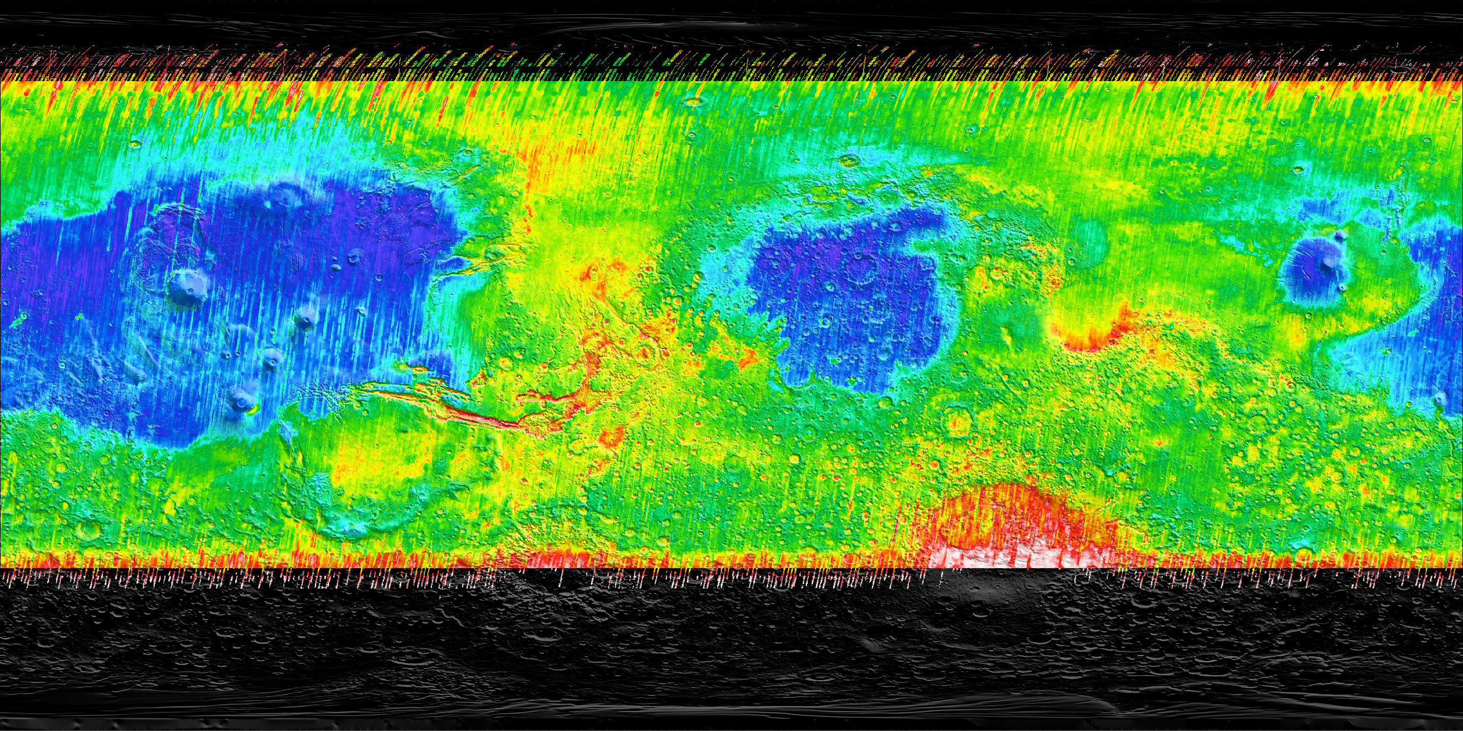 2880 x 1440 |
2.9 Mbytes |
TES Thermal Inertia
|
(Original, with coord. grid and legend)
|
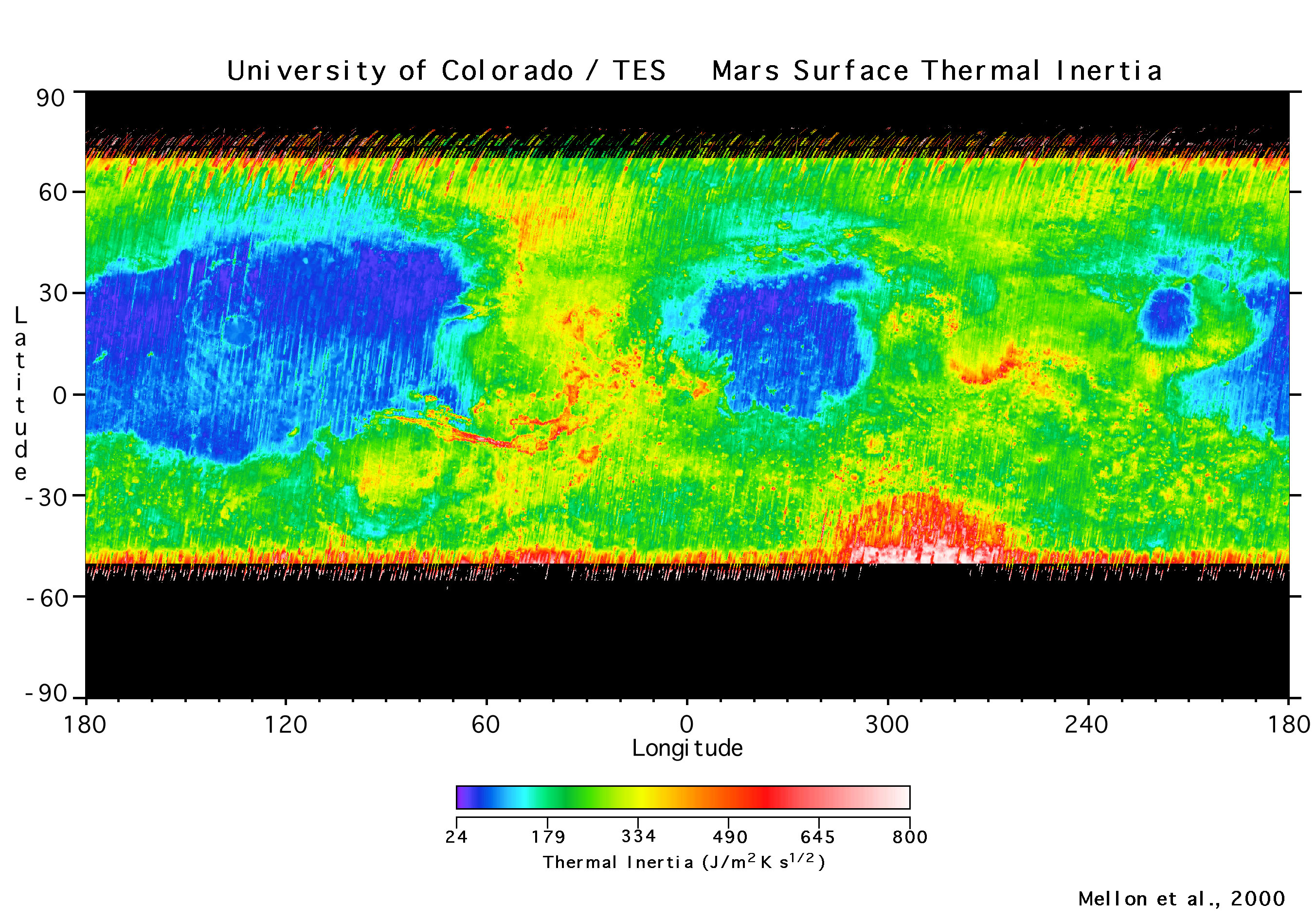 2705 x 1894 |
1.4 Mbytes |
MOLA
|
(cylindrical projection)
|
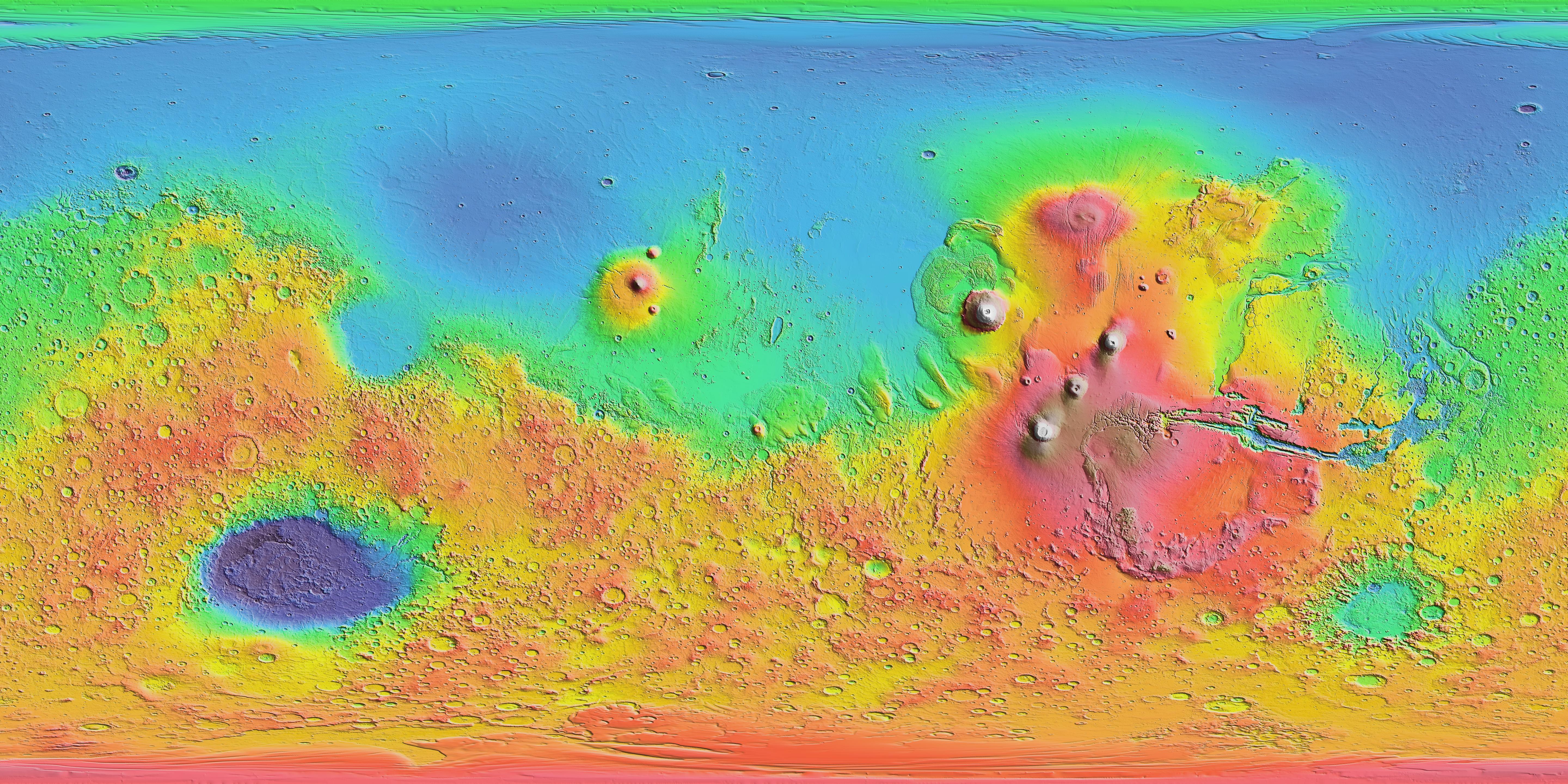 5760 x 2880 |
3.5 Mbytes |
MOLA
|
(high-resolution, Mercator projection)
|
 12032 x 6912 |
18 Mbytes |
Geology
|
(Composited with MOLA data)
|
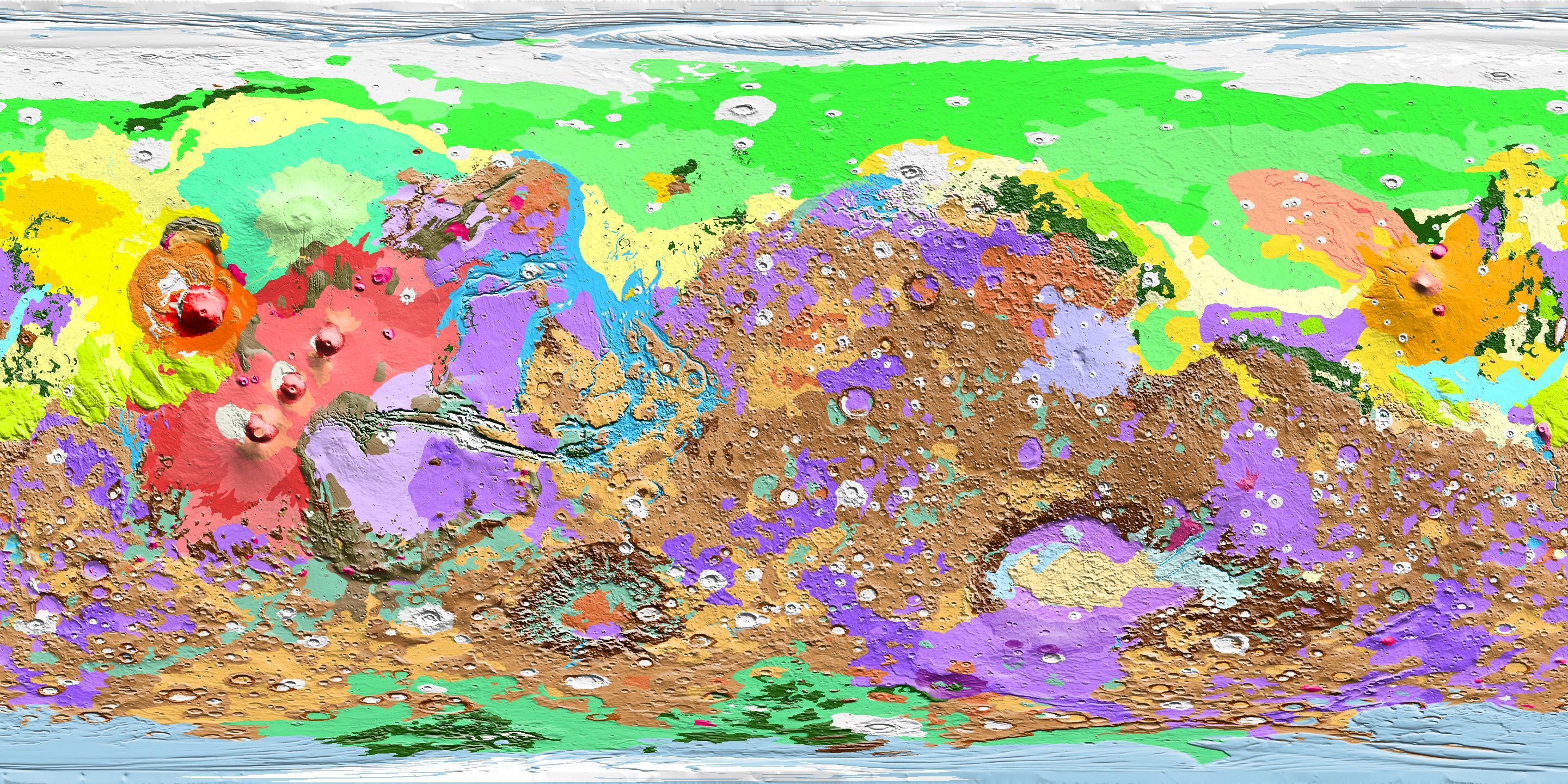 2880x1440 |
1.1 Mbytes |
Note: To download these large image files, you may need to use your browser's "Save Link to Disk" function on the image links.
| | |||||||||