
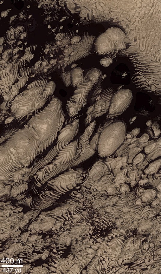
Mars, like the Earth, appears to be a layered planet, which has major implications for processes that have formed the geology we see today on the surface. Anyone who has ever gone to the Grand Canyon and seen the layering along the canyon walls may know that each layer records a different history for this region, such as a time in the past when the region was covered with a sea and sedimentary layers were emplaced, or a time when volcanism was active and produced volcanic layers. The arrangement of layers relative to each other, such as does one unit lie on top of another or does one layer cut through another, also tells us about the stratigraphy, which is how geologists determine the sequence of processes that occurred over time in a particular area.
HiRISE may show us that the layering on Mars is even thinner and more prevalent than we now know. HiRISE images of different layers on Mars can answer questions about the processes that produced the layers. For example, are the layers the result of sediments deposited in lakes or oceans on Mars? Do the layers form from volcanic eruptions pumping ash into the atmosphere that later settles on to the ground? Or perhaps the layers form from cyclic changes in the amount of dust that is entrained into the atmosphere and later deposited on the ground. Analysis of HiRISE data may shed new insight into the physical properties and age relationships of the layers which can then help scientists determine how the layers formed and what role water and climate change played in their deposition.
|
Figure 1. “Colorized” subframe of Mars Orbiter Camera image M14-01647 of layered deposits inside an impact crater in Western Arabia Terra. Hundreds of layers can be seen exposed by erosion. The layers are partially covered by dark debris that has filled in topographic lows between the layers. All the layers appear similar in their thicknesses and textures, suggesting they formed by the same process. What formed them? Perhaps deposition of sediments in water, or ash/dust settling out from the atmosphere. Illumination from the left. Figure courtesy of Malin Space Science Systems/NASA. (Click for larger version.) |
|
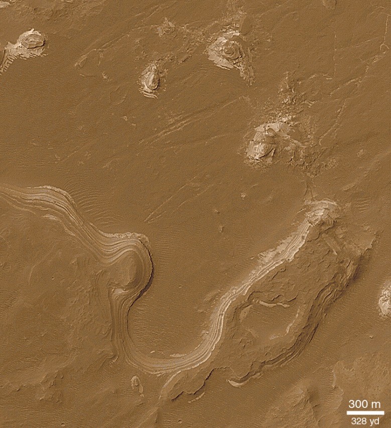
Figure 2. “Colorized” subframe of Mars Orbiter Camera image M03-02733 of layered deposits inside Holden Crater. Because a large valley called Uzboi Vallis can be seen entering into the crater, the layers shown here could be from the deposition of sediments in the water from this valley. Illumination from the upper left. Figure courtesy of Malin Space Science Systems/NASA. (Click for larger version.) |