|
This HiRISE image covers an area of Nili Fossae located on the northwestern margin of the Isidis Basin. The image covers an area in the general vicinity of terrains where the Omega instrument on board the Mars Express spacecraft has detected phyllosilicates, or clay minerals. The ancient surface is marked by numerous degraded impact craters and appears structurally complex. Much of the surface appears stripped, with remnants of a relatively darker unit appearing as mesas surrounded by talus in the lower portion of the image. Wind blown dunes comprised of relatively dark sediments are numerous. At the full resolution of the HiRISE sub image, the lighter unit covering much of the surface is seen to be intensely fractured, yet preserves many circular structures likely associated with ancient craters and other relief. The nature and origin of the fractured surface is unknown, but the fractures display little offset that would indicate they are faults. Rather, it appears that some process has disrupted the surface while preserving much of the original texture and structure.
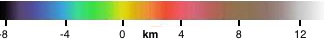
Image TRA_000883_2005 was taken by the High Resolution Imaging Science Experiment (HiRISE) camera onboard the Mars Reconnaissance Orbiter spacecraft on October 4, 2006. The complete image is centered at 20.4 degrees latitude, 78.5 degrees East longitude. The range to the target site was 281 km (176 miles). At this distance the image scale is 28 cm/pixel (with 1 x 1 binning) so objects ~84 cm across are resolved. The image has been map-projected to 25 cm/pixel and north is up. The image was taken at a local Mars time of 3:22 PM and the scene is illuminated from the west with a solar incidence angle of 46.7 degrees, thus the sun was about 43.3 degrees above the horizon. At a solar longitude of 115.7 degrees, the season on Mars is Northern Summer. |

